 Greater Noida
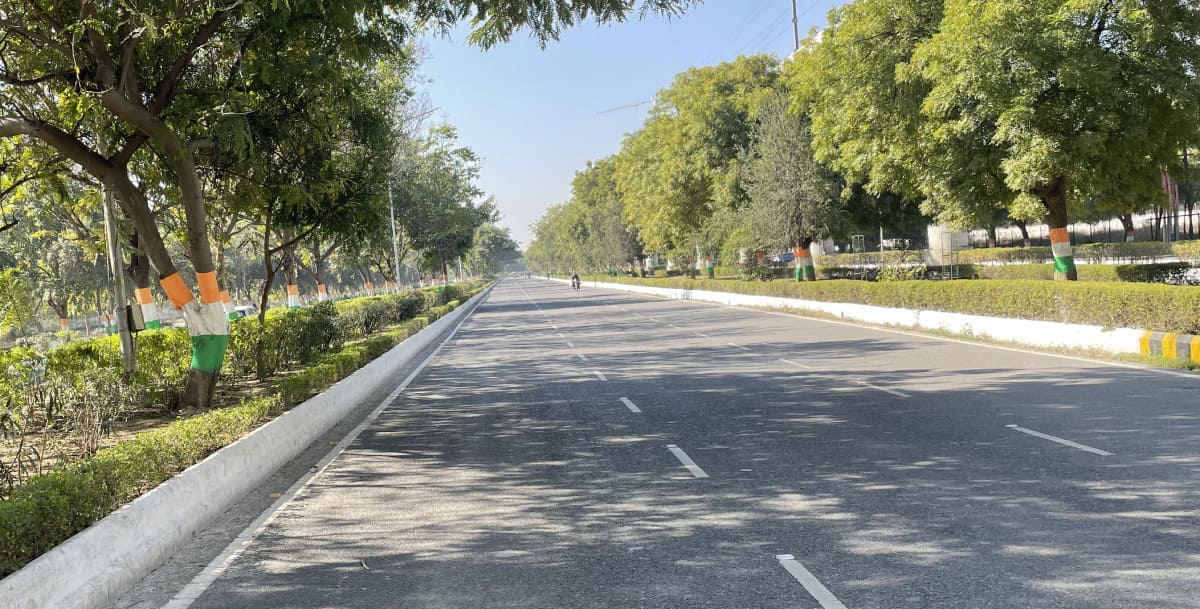
Geography is the study of land, climate, and places. It helps us understand how cities grow and change. A city’s location affects transport, weather, and daily life.
Greater Noida is a city in Uttar Pradesh, India. It is part of the National Capital Region (NCR).
The city is close to Delhi. It has wide roads, open land, and fast-growing industries. Its location makes travel and business easy.
A city’s geography decides its roads, weather, and industries. Flat land helps build homes and factories. Good transport makes travel simple. A clean environment improves living conditions
In this article, you will learn where Greater Noida is, how big it is, its weather, rivers, and transport. Let’s explore why this city is growing fast.
Location and Boundaries of Greater Noida
Greater Noida is located in northern India. It is in western Uttar Pradesh, close to Delhi and Noida. The city is part of a fast-growing urban area.
It is 40 km from Central Delhi and 25 km from Noida. Gurugram is 60 km away, and Agra is 180 km away. The city is connected by highways and expressways.
Greater Noida shares borders with many cities.
- North – Noida and Delhi.
- West – Gurugram and Faridabad in Haryana.
- South – Bulandshahr and Aligarh.
- East – Ghaziabad.
These borders help link the city to major business hubs. Many people travel daily to Delhi and Noida for work. The location makes it easy for trade and transport.
Land Area and Elevation of Greater Noida
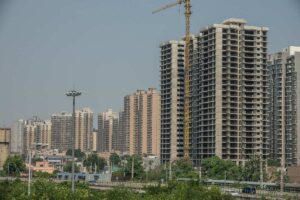
Greater Noida covers 380 square kilometers of land. It is a planned city with wide roads and open spaces. The city has homes, offices, industries, and parks.
The average height of the city is 203 meters. It is between 200 to 220 meters above sea level. This height keeps the city safe from floods.
The land is mostly flat with some lakes and green areas. Open parks and gardens make the city clean and fresh. Some areas have small water bodies that help nature.
Greater Noida is located at 28.4744° N latitude and 77.5040° E longitude. This position makes it close to Delhi and Noida.
Terrain of Greater Noida
The land in Greater Noida is mostly flat with a gentle slope. It slopes from the northwest to the southeast. This makes it good for building roads, homes, and industries.
The soil in the city is a mix of sand, clay, and other materials. This type of soil is good for farming and construction. Some areas have more sand, while others have more clay.
- Flat land makes it easy to build houses and roads.
- The gentle slope helps rainwater flow naturally.
- The soil mix supports farming in nearby villages.
- The ground is strong enough for high-rise buildings.
- Open land allows for planned development and wide roads.
The terrain helps in city planning and future growth. The mix of soil and flat land makes Greater Noida a good place for living and business.
Climate and Weather Patterns of Greater Noida
Greater Noida has a composite climate. It has hot summers, cold winters, and rainy monsoons. The weather changes every season.
Summers are hot and dry. The temperature is between 35°C to 45°C. Hot winds make it difficult to stay outside. People use fans, coolers, and air conditioners.
Winters are cold and foggy. The temperature is between 5°C to 15°C. Thick fog reduces visibility in the morning. People wear warm clothes and use heaters.
Monsoons bring heavy rain from July to September. The city gets 700-800 mm of rainfall every year. Rain cools the air but sometimes causes waterlogging.
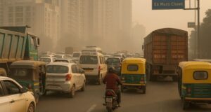
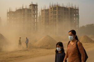
The air quality changes with the season. The AQI (Air Quality Index) ranges from 100 (moderate) to 400 (very poor). In winter, smog makes breathing hard for some people.
Rivers, Lakes, and Green Spaces in Greater Noida
Greater Noida has rivers, wetlands, and green parks. These places help nature and keep the air clean. They make the city cooler and more peaceful.
The Yamuna River flows near the western border of the city. It is an important source of water. Many farms use this river for irrigation.
The Hindon River flows near Greater Noida. It passes through nearby regions. The river helps in maintaining groundwater levels.
The Surajpur Wetlands is a natural reserve. Many birds and animals live here. It is a peaceful place with many trees.
- The wetland attracts migratory birds in winter.
- It has small lakes that store rainwater.
- People visit for birdwatching, nature walks, and photography.
The city has many parks and green spaces. Jaypee Greens, Biodiversity Park, and Knowledge Park have large open spaces.
- Jaypee Greens has golf courses, gardens, and luxury homes.
- Biodiversity Park has a variety of plants and walking trails.
- Knowledge Park has green zones near colleges and offices.
- These parks have jogging tracks, benches, and play areas.
- Many trees reduce air pollution and provide shade.
These green areas help in keeping the city fresh and clean. People visit them for exercise, relaxation, and fresh air.
Connectivity and Transport in Greater Noida
Greater Noida has good roads, metro, rail, and air connectivity. People can travel easily to nearby cities.
The Noida-Greater Noida Expressway connects the city to Noida and Delhi. The Yamuna Expressway links it to Agra and Jewar Airport. NH-24 and NH-91 connect it to Ghaziabad and other areas.
- Major highways: Noida-Greater Noida Expressway, Yamuna Expressway, NH-24, NH-91.
- Frequent buses, cabs, and autos run on these roads.
The Aqua Line Metro connects Greater Noida to Noida.
- Nearest metro: Aqua Line stations across the city.
- Future metro: Noida extension to Delhi and NCR.
The Dadri Railway Station is the nearest railway station. Anand Vihar and New Delhi Railway Stations serve long-distance trains.
The Jewar Airport is under construction and will improve air travel. Till then, people use Indira Gandhi International Airport in Delhi.
Impact of Geography on Development
Greater Noida is growing fast due to its location and planned expansion. The city has wide roads, open spaces, and good transport. Its geography helps in business, housing, and industries.
The city is built on flat land, making construction fast and easy. Its location near Delhi attracts companies, investors, and new projects. Well-planned roads help traffic move smoothly.
- Flat land allows easy construction of homes and offices.
- The location near Delhi brings businesses and workers.
- Roads and the metro make travel simple and fast.
Greater Noida is well-planned with proper zoning. Different areas are set for homes, offices, factories, and parks. Wide roads reduce traffic and improve transport.
- Wider streets help in smooth vehicle movement.
- Proper zoning keeps industries away from homes.
- Green spaces improve air quality and living conditions.
Industries grow fast because of expressways and open land. Factories need big spaces and good transport to move goods. The city’s location helps businesses expand easily.
- Expressways make it easy to transport goods.
- Large land areas support industrial growth.
- Nearby markets in Delhi and Noida increase business.
Greater Noida’s geography makes it a prime location for development. Its flat land, planned roads, and strong transport network support rapid growth.
Conclusion
Greater Noida covers 380 sq. km with flat land and open spaces. It has a gentle slope and mixed soil, making it good for buildings and industries. The city has hot summers, cold winters, and rainy monsoons.
It has rivers, wetlands, and green parks that help the environment. With expressways, metro, rail, and an upcoming airport, Greater Noida is growing fast in transport and development.